
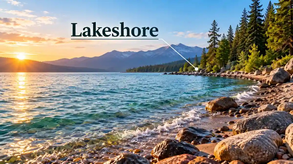
A lakeshore is the land bordering a lake, where the water meets the surrounding ground. It may include sandy beaches, rocky edges, grassy banks, wetlands, or cliffs. For example, the sandy stretches along Lake Michigan and the rocky cliffs along Lake Superior are both lakeshores, despite their very different appearances.
The lakeshore meaning applies to lakes worldwide, whether they contain freshwater or saltwater. These environments vary with the surrounding landscape, climate, geology, and water movement. Although terms such as lakeside, lakefront, and shoreline are often used interchangeably, each has a slightly different emphasis in everyday language.
Where Is a Lakeshore Located?
A lake’s shore extends along its perimeter, creating a transition between land and water. Depending on the surrounding terrain, this area may be a narrow strip of exposed sand, a gently sloping bank, or a steep rock face rising directly from the water.
Some lakes are surrounded by forests or mountains, while others border grasslands, agricultural areas, towns, and developed waterfronts. These surroundings help determine the appearance and natural characteristics of the shore.
The water’s edge is not always fixed. Heavy rainfall and snowmelt can raise lake levels, temporarily covering previously exposed ground. During dry periods, falling water levels may reveal additional sand, rocks, or soil.
This distinction is important in geography: the lake is the body of water, while its shore refers to the adjoining land. On maps, the shoreline generally represents the boundary between the two at a particular water level.
Common Natural Features of a Lakeshore
Not every lake edge looks like a sandy beach. Its physical characteristics depend on local geology, wave activity, sediment, vegetation, and climate. Several different environments may even exist around the same lake.
Sandy, Rocky, and Vegetated Shores
Sandy shores develop where sand accumulates along the water’s edge. Waves and currents redistribute loose sediment, while wind may carry dry sand inland to form dunes. These landscapes are common along portions of the Great Lakes.
Rocky shores occur where bedrock, gravel, or large stones border the water. Some form cliffs, while others have gently sloping surfaces covered with pebbles. Waves and weathering gradually reshape exposed rock formations.
Vegetated shores support grasses, shrubs, reeds, and trees. Their roots can help stabilize soil, reducing erosion under suitable conditions. Plants also provide food, shelter, and nesting areas for wildlife.
Wetlands are another important feature. Marshes may develop where shallow water meets low-lying land, creating habitats for fish, amphibians, insects, and waterbirds.
The surrounding wildlife depends on local conditions. Ducks may feed in shallow water, frogs often occupy wetland vegetation, and fish may shelter among submerged plants or rocks.
A single lake can contain several of these environments. One section might feature a sandy swimming beach, while another has exposed bedrock or a densely vegetated bank.
Lakeshore vs. Lakeside, Lakefront, and Shoreline
These terms describe related locations, but their meanings are not completely identical. Understanding the differences makes geographical descriptions clearer.
| Term | Meaning | Common usage |
| Lakeshore | Land bordering a lake | Natural features and geographic areas |
| Lakeside | Beside or near a lake | Describing the location of places or activities |
| Lakefront | Land directly facing or bordering a lake | Waterfront homes, parks, and developed areas |
| Shoreline | Boundary where land and water meet | Geographical descriptions of lakes, rivers, seas, and oceans |
For example, someone walking along Lake Michigan may be exploring its shore. A restaurant situated beside the water could be described as lakeside, while a house directly overlooking the lake might be called lakefront property.
The word shoreline has a broader geographical application because it can describe boundaries around different bodies of water, not just lakes.
These distinctions reflect common usage rather than strict scientific classifications. The terms sometimes overlap, particularly when describing land directly adjacent to water.
How Lakeshores Change Over Time
Lake edges are constantly influenced by natural processes. Waves, weather, seasonal water levels, and sediment movement can gradually change their shape and appearance.
One major process is shoreline erosion, which occurs when waves, moving water, ice, or other forces wear away soil and rock. Strong waves may remove sand from beaches, while repeated weathering can weaken exposed cliffs.
Sediment deposition has a different effect. Instead of removing material, it occurs when sand, silt, or gravel settles in an area. Over time, these deposits may build or reshape beaches and shallow banks.
Water levels also affect the visible landscape. Rainfall, evaporation, snowmelt, and longer-term climate patterns influence how much land remains exposed along the water.
Vegetation can help limit erosion by holding soil together and slowing surface runoff. However, its effectiveness depends on the plants, soil conditions, slope, and wave energy.
Human activities can also alter natural processes. Removing vegetation, constructing retaining walls, or modifying the shoreline may affect how sediment moves and where erosion occurs.
Examples of Lakeshores in the United States
The Great Lakes—Superior, Michigan, Huron, Erie, and Ontario—provide some of North America’s most recognizable lake environments. Their extensive shorelines include beaches, dunes, cliffs, forests, wetlands, and developed waterfronts.
The U.S. National Park Service protects several remarkable examples through areas designated as National Lakeshores.
Pictured Rocks National Lakeshore, Michigan
Located along Lake Superior in Michigan’s Upper Peninsula, Pictured Rocks National Lakeshore is known for its colorful sandstone cliffs, beaches, dunes, and forests.
Its rock formations demonstrate the effects of waves, weathering, and erosion. Mineral-rich groundwater also creates distinctive colors on the sandstone cliffs.
The National Park Service’s geological overview explains how these formations developed and continue to change.
Sleeping Bear Dunes National Lakeshore, Michigan
Sleeping Bear Dunes National Lakeshore lies along Lake Michigan and features extensive sandy dunes, high bluffs, beaches, and forested landscapes.
Wind moves sand inland, while waves erode exposed bluffs and redistribute sediment. This combination creates a landscape that changes gradually over time.
The National Park Service’s dune explanation describes how wind, waves, and vegetation influence these formations.
Apostle Islands National Lakeshore, Wisconsin
Located along Lake Superior, Apostle Islands National Lakeshore includes islands, rocky shorelines, beaches, and forested environments.
Its varied terrain illustrates how lake shores can contain multiple natural habitats and geological features within the same region.
The National Park Service’s nature overview provides additional information about the area’s environment.
Why Lakeshores Matter
The boundary between land and water plays an important ecological role. Shoreline vegetation and wetlands provide habitats for wildlife, while shallow areas offer feeding and shelter opportunities for many aquatic species.
Natural plant communities can also stabilize soil, filter some runoff, and support water quality. Their effectiveness varies with local environmental conditions.
These areas provide opportunities for swimming, fishing, walking, and observing nature. Protecting native vegetation and limiting unnecessary disturbance helps maintain healthy shoreline environments.
A lakeshore is therefore more than the visible edge of a lake. It is a changing natural environment where water, land, climate, and living organisms interact.
Frequently Asked Questions
What does lakeshore mean in simple words?
A lakeshore is the land along the edge of a lake, where water meets the ground. It can include beaches, rocks, grass, wetlands, or other natural features.
Is a lakeshore the same as a beach?
No. A beach is one possible feature along a lake’s edge. Other sections may consist of rocky cliffs, muddy banks, wetlands, or vegetation-covered ground
What is the difference between lakeshore and lakefront?
Both terms describe land bordering a lake. Lakeshore is commonly used in geographical descriptions, while lakefront often refers to properties, parks, or developed waterfront areas.
Can a lakeshore be rocky instead of sandy?
Yes. Rocky shores occur where bedrock, gravel, or large stones border the water. Lake Superior’s sandstone cliffs are a well-known example of rocky shoreline terrain.
Does every lake have a shoreline?
Yes. Every lake has a boundary between its water and the surrounding land. That boundary may include natural terrain, vegetation, or human-made structures.
What causes lakeshore erosion?
Erosion occurs when waves, currents, ice, weathering, or changing water levels wear away shoreline materials. Human activities, including vegetation removal and shoreline construction, can also influence erosion.
What is a National Lakeshore in the USA?
A National Lakeshore is a protected area within the U.S. National Park System. Examples include Pictured Rocks, Sleeping Bear Dunes, and Apostle Islands, which preserve significant lake-related natural and cultural landscapes.